Bellevue Area Run & Walk Maps
Maps starting from SHOES-n-FEET, located in the Lake Hills area of East Bellevue - 15015 Main Street
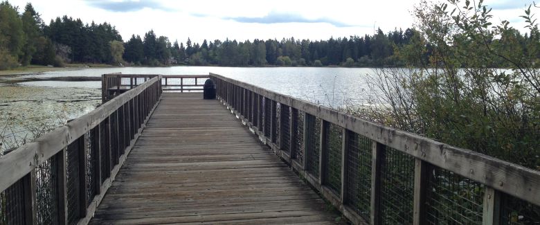
Phantom Lake 5K - In three short miles, run through blueberry fields, woods and the wide open trails of the Lake Hills Greenbelt Park to Phantom Lake. This course is a flat and easy going route. Map
Phantom Lake 5 Miler - Extend the Phantom Lake 5K with a few rolling hills on the bike path around Phantom Lake. Map
Lake Hills 7 Miler - Starting on a similar route for the Phantom Lake 5K, but extending the route south towards Eastgate to include the Spiritridge Trail and Robinswood Park. Map
Powerline 5K - Work some rolling hills into your routine and do a 5K loop on the power line trail near Sammamish High School. Map
Kelsey Creek 5 Miler - Extend the Powerline 5K route with a loop through bucolic Kelsey Creek Farm that includes wooded trails and a barnyard loop. Map
Wilburton Hill & Kelsey Creek 6 Miler - Hit up two of east Bellevue's wooded parks, Kelsey Creek Farm & Wilburton Hill Park, in this loop. On a clear day, you'll get views of Olympic Mountains at the corner of NE 8th St. and 124th Ave NE. Map
Other places we like to run and walk in Bellevue
Downtown Bellevue 5K - Start and end this route at Bellevue Downtown Park and be rewarded with amazing views of Lake Washington within the first mile. Map Coordinates: 47.611657, -122.203083
Woodridge Open Space 1.5 Mile Loop - A little known jewel of a wooded path just off the Lake Hills Connector. Add this onto another nearby route, or just use as an easy/short amble. Map Coordinates: 47.595343, -122.166734
Mercer Slough 4 Mile Loop - A flat trail through the Mercer Slough Park just off the I-90/I-405 interchange. Close to the highway, but for much of the loop you wouldn't know it. Loop starts and ends at the South Bellevue Park & Ride. Map - South Bellevue Park & Ride
Sky Country and Red Town Trailheads - Launching points for your Cougar Mountain adventure. Cougar Mountain is completely forested with well-maintained and marked trails where trail addicts can run or walk for miles and miles. PDF MAP - Red Town Trailhead - Sky Country Trailhead
Other places we like on the "Eastside"
Woodinville
Tolt Pipeline Trail - Starting at the parking area off Avondale Road, you can head westbound towards Route 202 / Sammamish River or Eastbound towards Duvall. Both routes pack a punch of ups and downs with the westbound 6.5 mile out and back containing 1,000 feet of ups and downs and the eastbound 7 miles containing 700 feet. Westbound Map - Eastbound Map - Parking Coodinates: 47.736497, -122.080443
Other Woodinville locations: Paradise Valley Conservation Area, Sammamish River Trail
Redmond
Redmond Watershed - Well-maintained wide trails through a beautifully preserved watershed forest on Novelty Hill in Redmond. Frequented by deer and the occasional black bear, the watershed is a wilderness wonderland tucked into Redmond horse country. Add on trails through Redmond Ridge or Trilogoy housing developments to make a longer route. Map - Parking Location
Other Redmond locations: Sammamish River Trail, Farrel-McWhirter Farm Park, East Lake Sammamish Trail
Kirkland
Bridle Trails State Park - A forested gem tucked into suburban Kirkland, the Bridle Trails State Park has the potential to string together much more than the 4 mile loop described. Besides the horses on the trails, you might run into one of three friendly packs of coyotes that live in the park. Parking requires a Discover Pass. Map - Parking Location
Other Kirkland locations: Cross Kirkland Corridor
Issaquah
Chirico Trail to Poo Poo Point - Your gateway trail to Tiger Mountain adventures start on the Chirico Trail. Named for the owner of the paragliding school near the trail head, the one-way 1.8 mile trail guides you up approximately 1,800 feet of elevation gain to Poo Poo Point, one of the lesser summits of Tiger Mountains. On clear days, stop at the South paraglider take-off point (about 1.6 miles in) for spectacular views of Mt. Rainier. On nice days, you'll be treated the excitement of paragliders launching from both the South and North launch points. Map - Parking Location
Run with the Kokanee 5K Loop - This is the course for the annual Run with the Kokanee 5K. The route is pancake-flat with a mix of bike path, sidewalk and trail. Map - Coordinates: 47.558759, -122.062880
Other Issaquah locations: East Lake Sammamish Trail, Tiger Mountain, Squak Mountain
Sammamish
Soaring Eagle Park - Maintained by King County, Soaring Eagle Park has 12 miles of trails. Much of the trail is well maintained single track through a beautiful dense forest.
Other Sammamish location: East Lake Sammamish Trail
Kenmore
St. Edward State Park - Situated along Lake Washington's eastern shore, St. Edward State park has ample parking and miles of trails. Bring your Discover Pass to park.
Other Kenmore location: Burke-Gilman Trail